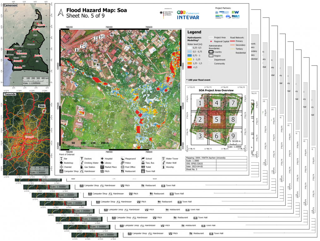
After a hydraulic runoff simulation had already been carried out for the project area Soa last year, flood hazard maps were created in the form of an atlas using the open source software QGIS to visualize the results.
The project area was covered with a grid, for whose subareas separate flood hazard maps were automatically generated. The advantage of an atlas is that, on the one hand, map details can be recognized much better and, on the other hand, the workload will significantly be reduced in case map updates are necessary.