

The Institute of Hydraulic Engineering and Water Resources Management (IWW) at RWTH Aachen University has reached an important milestone by completing the first flood hazard maps for the project area Soa.
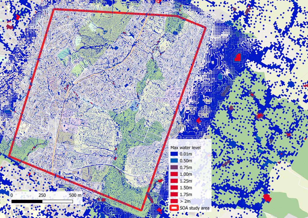
Based on the drone photos and a terrain model created from the photos, a hydraulic runoff simulation was performed in the ProMaIDes software developed at IWW. The exemplary flood map shown in the figures applies to a rainfall event with a maximum intensity of 25 mm/h for a one-hour rainfall, which was simulated with two hours of lag time.
The difference between the high-resolution terrain model created with drone imagery (horizontal resolution 1 m) in the project area and the much coarser resolution satellite data outside the project area (horizontal resolution 12 m) can be clearly seen. The satellite data were used to simulate two catchments in addition to the project area, both containing the project area, in order to calculate realistic boundary conditions for the project area.
In close cooperation with the Cameroonian partners, further flood maps for different rainfall events are currently being calculated and visually processed in order to be used in disaster risk management.